Pacaska Property
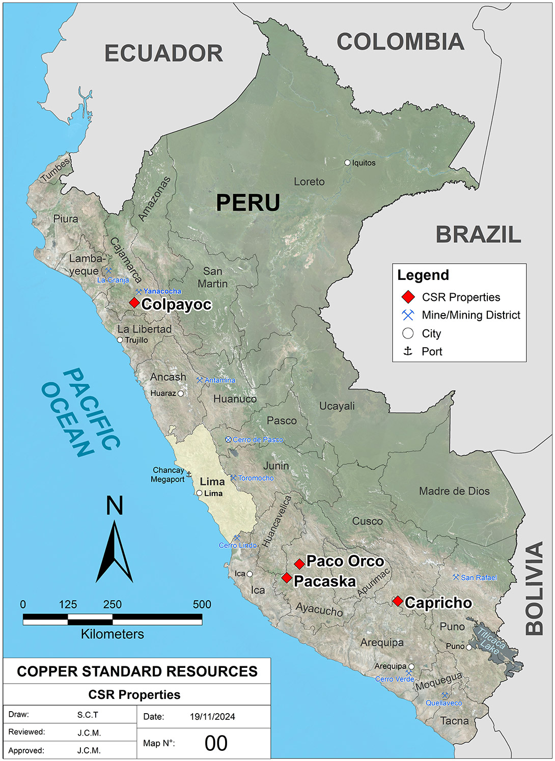
The Pacaska property, located in the Laramate district, contains a grassroots discovery of an outcropping high-sulfidation epithermal gold system with a possible porphyry copper-gold system at depth. The mining concessions cover 7,650 hectares of mineral rights located in the Department of Ayacucho in southern Peru, about 175 km southeast from Nexa’s Cerro Lindo base metal mine, and about two and a half hour’s drive on paved road from Palpa, a small agricultural town near the coast.
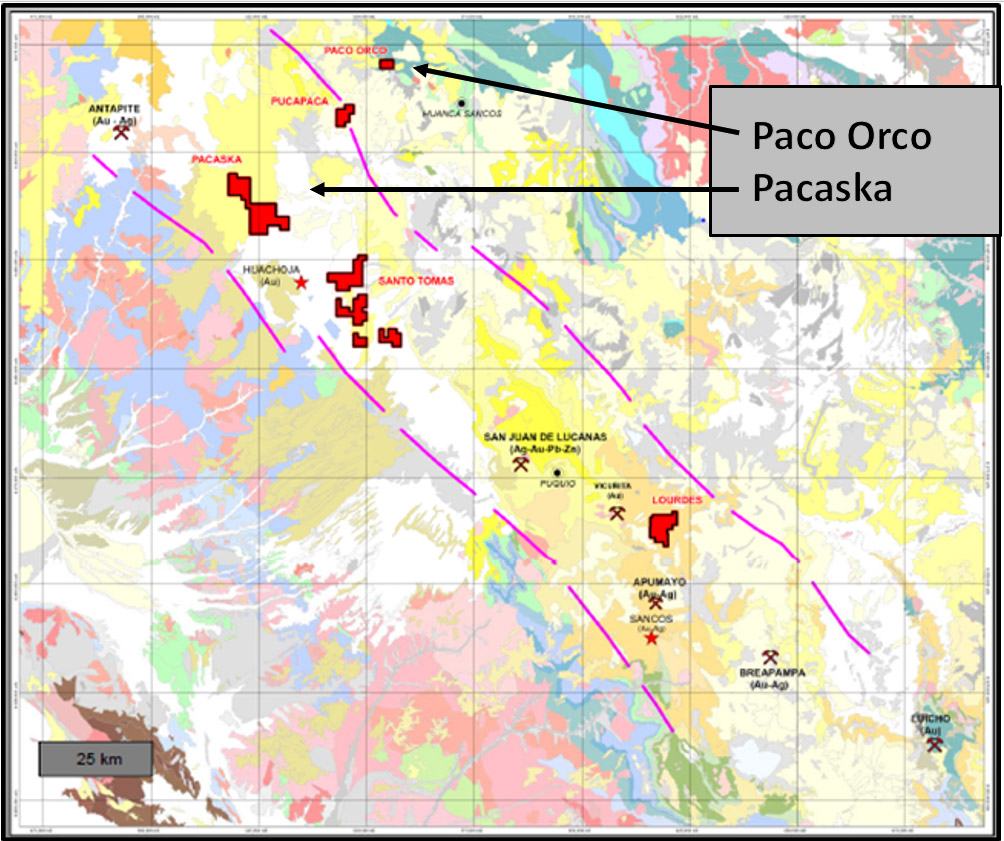
The property is located within the western flank of the Cordillera Occidental, within the Lucanas – Breapampa Mineral Belt (“LBMB”) and straddles the Andean Continental Divide at about 4,000 meters elevation. The LBMB contains several high-sulfidation gold systems like Pacaska that were mined at mina Breapampa operated by Buenaventura and mina Apumayo operated by Aruntani. Work to date has identified widespread elevated gold mineralization in the 0.2 – 1.0 g/t Au range with local values up to 17 g/t gold and 11% copper. Mineralization is hosted within a very large advanced argillic alteration zone with extensive vuggy-silica and polyphase hydrothermal breccias. Mineralization and alteration is most similar to mineralization at the Pierina mine and deposits within the Yanacocha District in northern Peru.
Pacaska Program Status
Exploration Data: The Pacaska Property has received systematic, high quality exploration dating back to 2015. All data is stored in the Company’s dataroom, and includes raw files and GIS files:
- Detailed mapping, rock sample assays, PIMA spectral analyses and limited petrography
- Rock Samples – 868 as of August 2017
- Pima Analyses – 511 as of August 2017
- Systematic soil sampling – multi-element geochemical analyses and evaluation
- Ground Magnetics Survey
- Induced Polarizastion Survey – Dipole/Dipole array
- Geology Reports by Richard Sillitoe, Steve Park, Keith Laskowski and Ken Balleweg
Drilling: The property has received no modern drilling. There are historic drill pads located within Quebrada Yanasora, however no records are available. Limited drilling was completed in the north end of the Llamoca target area by IAMGOLD. Neither Copper Standard or Pucara Gold have completed any modern drilling based on the recently completed systematic geochemical and geophysical programs.
Permitting: Copper Standard is working towards filing Environmental Assessment reports and applying for an exploration permit, which will require a Consulta Previa. These applications are in process.
Geology, Alteration and Mineralization
Regional Geology: Pacaska is located within a belt of porphyry/epithermal altered Miocene volcanic rocks (Figure 3. Shown in yellow) of the Tacasa and Castro Vey Rena Formation. These are made up of mainly of porphyritic andesites and andesitic lithic and welded lithic tuffs. Distinctive variably welded ignimbritic lithic tuff is present, often exposing leached fiame in a silicified matrix. Outcrop is restricted to <5% of the surface however large areas have rubble crop indicating bedrock is not very deep. These are uncomformably overlain by volcanoclastic lithic tuffs and dacitic ignimbrites of the Caudalosa Formation. Structurally the area is dominated by the NW‐SE Andean fault system with crosscutting NE‐SW structures producing elongated silica bodies andesitic subaerial volcanics. These rocks are similar age and composition to the host rocks at Pierina and Yanacocha Gold Districts.
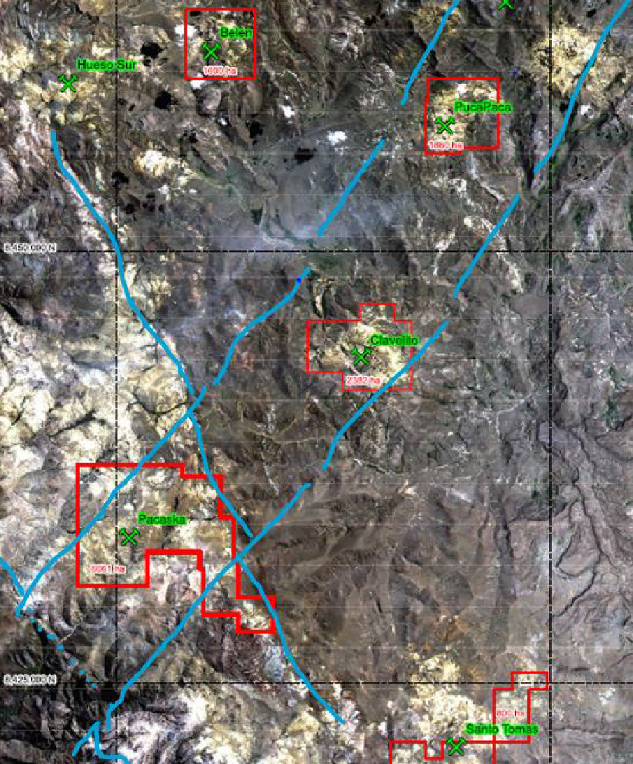
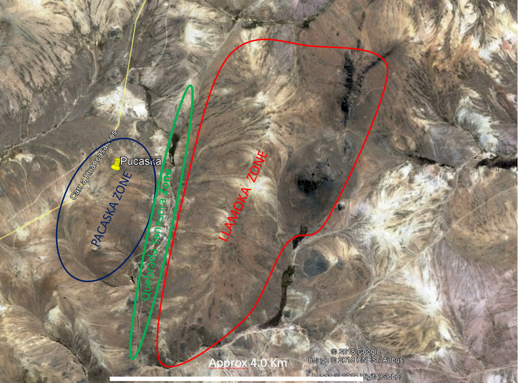
Alteration and Structure: The Pacaska Property contains a huge area of hydrothermal and epithermal alteration, readily visible with satellite imagery (Figure 4). Most of the alteration is white clay containing a variety of epithermal clays, mostly kaolinite and smectite, classified as argillic alteration. Regional Landsat imagery demonstrates post-alteration volcanics that cover the altered sequence. The alteration defines a strong north-northeast trend, similar to zones on Pacaska. The northeast alignment of alteration zones, and northeast alignment of alteration at Pacaska suggest the presence of a crustal scale structure. Pacaska contains a center of high-sulfidation epithermal alteration within this large argillic alteration zone. Pacaska is located at a major structural intersection between northwest trending arc-parallel Cordilleran structures and younger, northeast trending post Cordilleran structures.
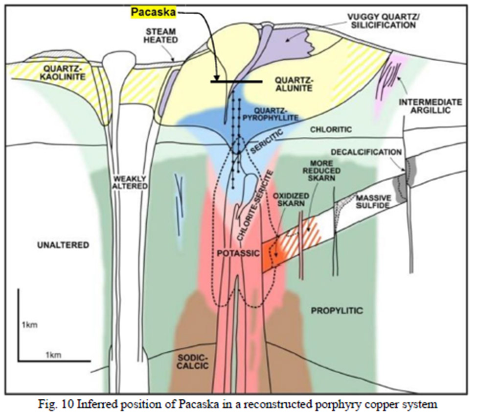
Alteration is dominantly advanced argillic, high‐sulfidation (HS) type with variable mineral assemblages of kaolinite, alunite, dickite, pyrophyllite, illite, diaspore and topaz associated with massive‐granular‐vuggy silica bodies (Pacaska Zone) and hydrothermal breccias (Llamocca Zone). Porphyry type alteration is present at the lower elevations as “patchy‐wormy” gossano transition textures, with pyrophyllite and tourmaline‐mica assemblages (Quebrada Yanasora Zone), pyrite stockwork veins, chalcocite veinlets, and quartz‐molybdenite veinlets (type B veins). The elevation and textures are interpreted to identify the transitional alteration zone between overlying epithermal and underlying higher temperature porphyry-related alteration. The HS alteration zone at Pacaska is interpreted to represent a mineralized lithocap above a porphyry copper‐gold system.
Mineralization Target Areas: Pacaska contains two main ridges of advanced argillic alteration, covering an area of about 20 square kilometers. These include the West Zone/Pacaska and the East Zone/Llamocca separated by Quebrada Yanasora Zone. Pacaska and Llamocca contain mainly advanced argillic, epithermal alteration but Quebrada Yanasora contains transitional alteration typical of the base of epithermal alteration and the top of porphyry style alteration.
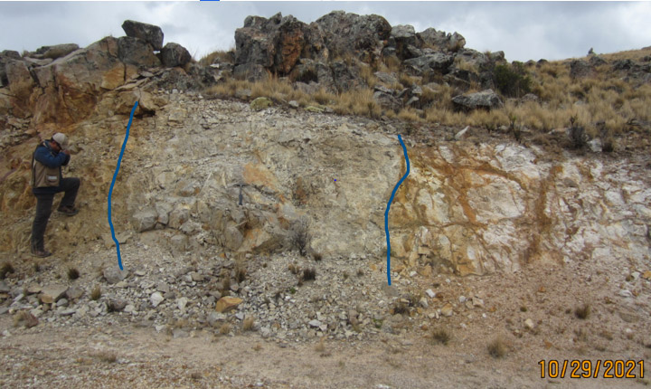
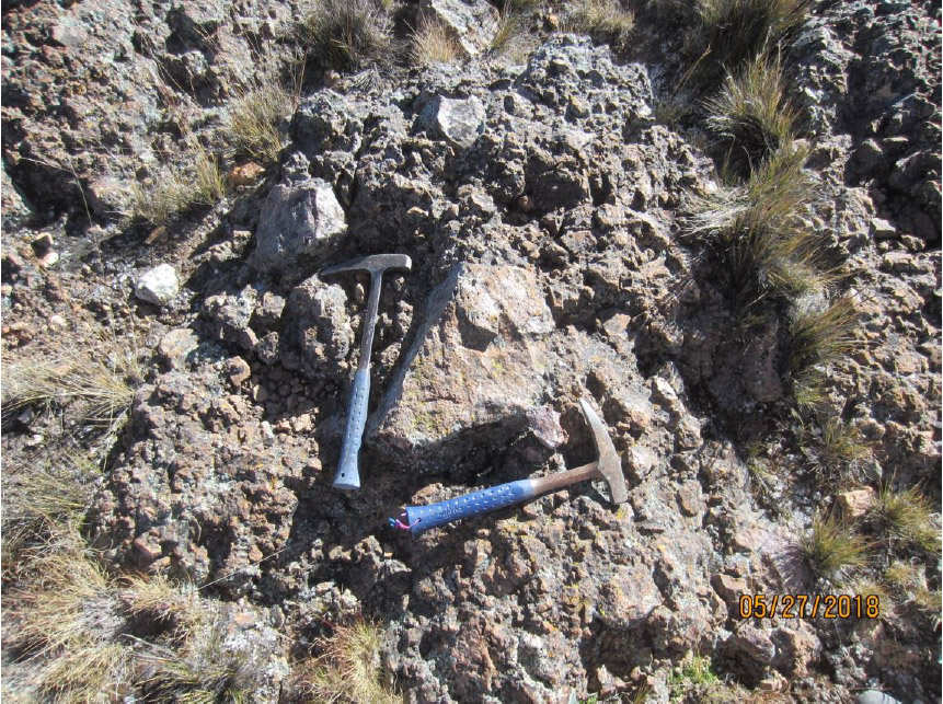
Mineralization – West Zone/Pacaska Target Area: The West Zone contains an area of outcropping/sub-cropping/covered highly altered volcanic rocks extending at least 3.0 km north-northeast and 1-2 km east west. The geology contains Miocene rhyodacitic volcanics however detailed stratigraphy has not been determined. At least three phases of silicification have been identified at Pacaska, mainly associated with breccias. Some breccias contain clasts of massive silica-alunite, indicating that deeper in the stratigraphy there was a possible silicified hydrothermal cap, or jasperoid (Phase I). Subsequent explosive brecciation of this cap moved the fragments upward, now occurring within vuggy silica altered breccia (Phase II). Figure 6 shows clast of massive silica-alunite in a vuggy-silica altered secondary breccia and vuggy-silica altered angular clast within breccia. Vugs may contain younger euhedral fine grain quartz crystals precipitated on vug linings (Phase III) followed by orpiment, alunite, and native sulfur. This Phase III event was accompanied by low grade gold mineralization which assays in the 0.2 – 1.0 g/t gold range, accompanied by strong arsenic, and antimony. High grade gold values have been identified within the mineralized tuffs with values up to 5.0 g/t from iron oxide rich fault zones (Figure 7). The West Zone also contains possible Phase IV silica which occurs as creamy-brown late veins, which are associated with very high gold grades in other epithermal deposits.
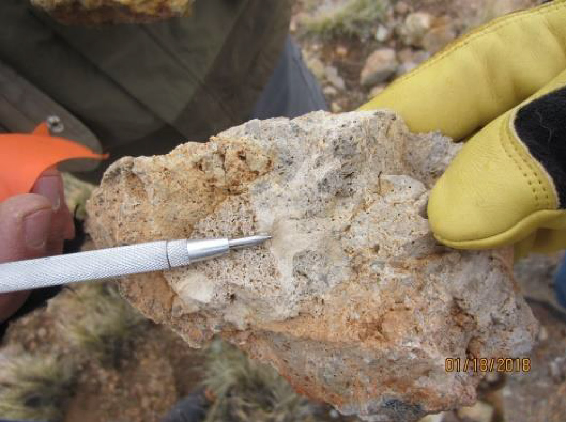
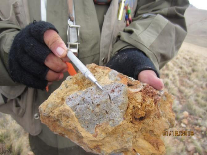
Figure 6. West Zone/Pacaska (B3 WP 152) – Left: Clast of massive silica-alunite in a vuggy silica altered secondary breccia. Right: Angular clast of vuggy silica altered lithic tuff with native sulfur and hematite in vugs. Jarosite in silica matrix. Hand sample shows early massive clear quartz with vugs, later euhedral fine grain euhedral quartz crystals precipitated on vug linings followed by orpiment, alunite and native sulfur.
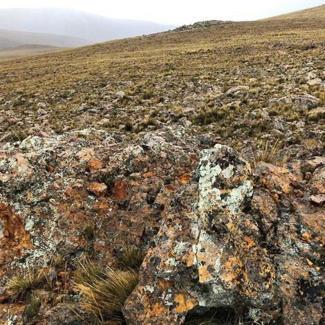
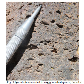
Figure 7. West Zone/Pacaska: – Left: Vuggy-silica altered breccias with structurally controlled 5 g/t gold assays associated with strong FeOx. Right: Vuggy Silica alteration.
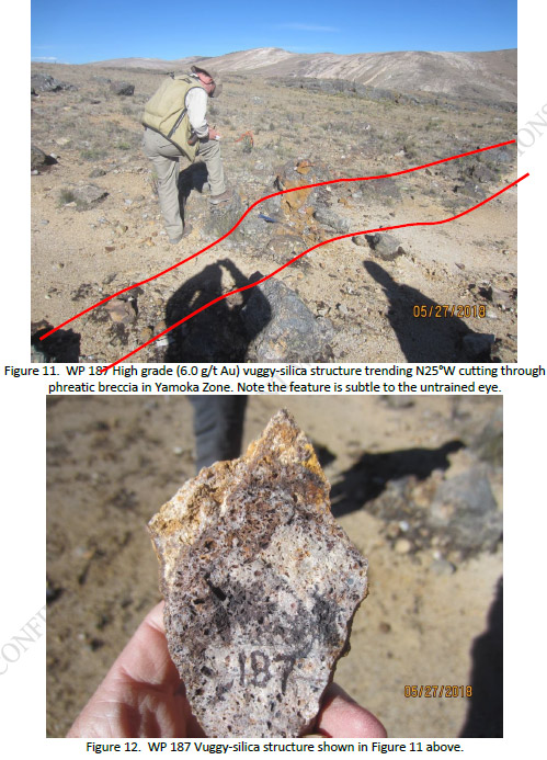
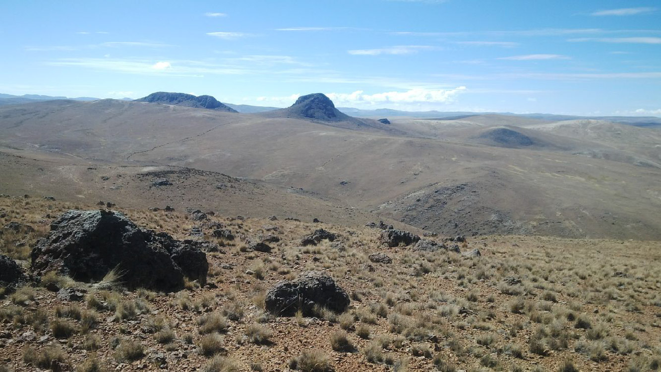
Mineralization – East Zone/Llamocca Target Area: The Llamocca area contains very prominent silicified hills that rise hundreds of meters above the broad ridge. The main feature at Llamocca is the presence of wide spread phreatic breccia, some of which appears to be bedded suggesting an eruptive diatreme origin. The wide spread breccia contains variable clast compositions but favorable vuggy silica and iron oxides after sulfide are common. The Llamocca Zone extends more than 5.0 km. Some of the phreatic breccia contains angular clasts and blocks (some more than a meter in diameter) that are composed of well-developed vuggy silica altered rock. This means that the phreatic breccia exploded through an underlying major sequence of vuggy silica alteration. In turn, the phreatic breccias are cut by steeply dipping vuggy-silica altered structures that carry high grade gold mineralization with values up to 18.0 g/t gold.
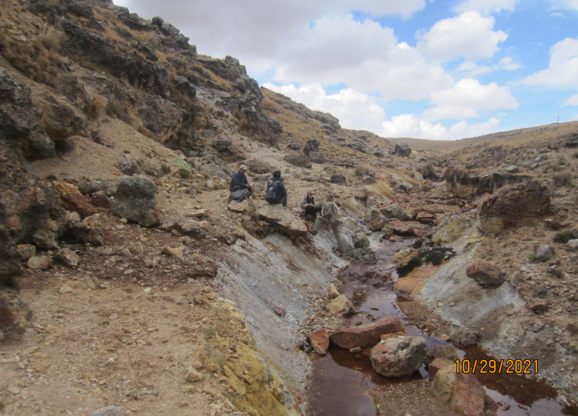
Mineralization – Central Zone/Quebrada Yanasora Target Area: The north-south ravine that separates the East and West Zones contains extensive sulfide alteration (Figure 5). The drainage is 200 – 300 meters lower in elevation than the adjacent vuggy-silica altered volcanics and contains both altered volcanics and intrusions. Limited outcrops expose sulfide altered volcanics and a large body of sulfide-rich equigranular altered intrusive. This area is considered to be the top of an andesitic dome complex, possibly the driving force for the epithermal alteration exposed in the overlying rocks. The andesitic dome contains 2-4% enargite with lesser pyrite that occurs as matrix replacement around relict plagioclase crystals. These sulfides weather to a variety of oxide minerals including limonite, scorodite, jarosite, chalcocite, local orpiment, realgar, and possible chalcanthite.
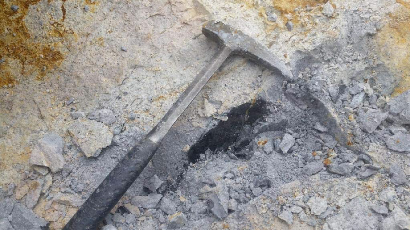
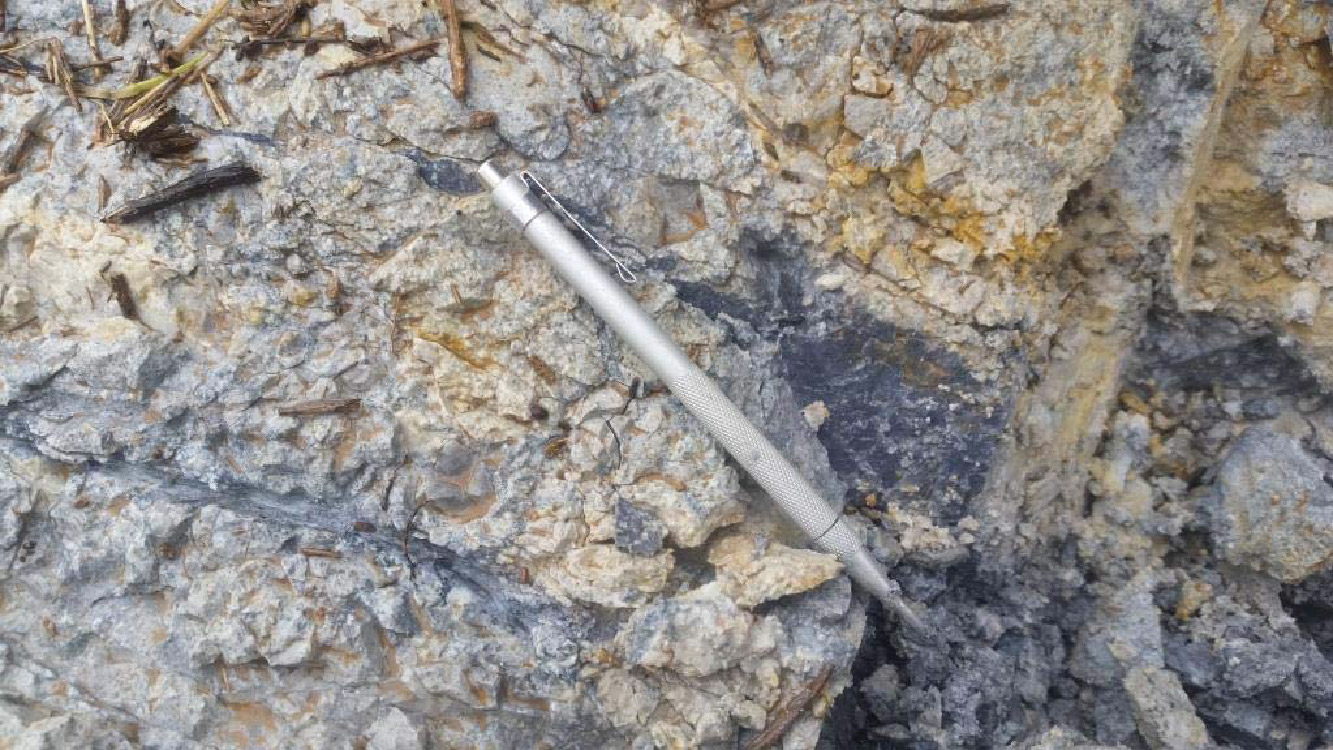
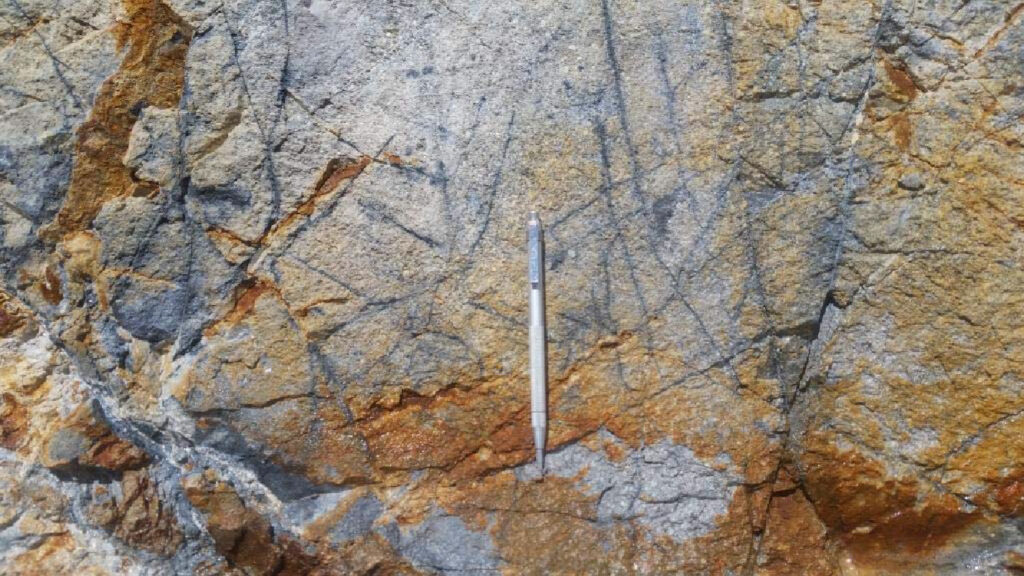
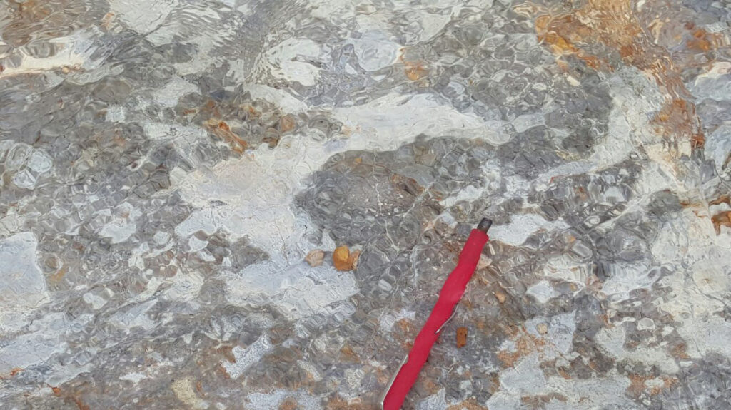
Mineralization-Porphyry Copper-Gold System: There is reasonable geochemical and geophysical evidence that the Pacaska alteration system is sitting above a porphyry system, as evidenced by the presence of significant copper and molybdenum values both in the West Zone and with stronger values at lower elevations in the Quebrada Yanasora Zone. In addition to multiple brecciation events with well-developed alteration assemblages, the geochemical values from rock samples demonstrate that this is a very strong hydrothermal system as evidenced by high concentrations of gold, arsenic, lead and bismuth. Elevated lead and bismuth are signature elements at the Pierina deposit.

Corporate Head Office:
Suite 3200 – 733 Seymour Street
Vancouver BC, V6B 0S6
Site Map

